OLA SHAKER
Architect
PARADIGM SHIFT

PROJECT | 01
Self-portrait
Portrait in the time of COVID_19
Modernity is a very common term. Despite its importance, we do not really think about its true meaning. It can be defined in several ways and each is linked to a specific time, starting point, or event. Modernity is chronological, progressive and positive. It means MOVING FORWARD.
Modernity is a complex matter intertwining crisis with action; with the help of modernity we are able to fight crisis, invent and survive.
Although Information Technology could be considered a crisis, it is a tool to drive creativity and innovation. It is how we use it.
Keywords: crisis, dramatic, change, cinema, music, architecture, war, invention.
PROJECT | 02
Synopsis & Review
Crisis Modernity and Information Technology
The Aniene is a 99-kilometer river in the province of Lazio, Italy. It originates in Trevi nel Lazio (Figure 1) and joins the Tiber in northern Rome (Figure 2). It formed the principal valley east of ancient Rome and it became an important water source as the city's population expanded. Historic bridges across the river include the Ponte Nomentano (Figure:3), Ponte Mammolo (Figure:4), Ponte Salario (Figure:5), and Ponte di San Francesco (Figure:6).

PROJECT | 03
1. Aniene Flow Project
Aniene Flow A BioInformation Infrastructure for the Rehabilitation of UnLost Territories
Figure 1: Cascata di Trevi nel Lazio, Source: anienewilderness.it

Figure 2: Aniene River map, Source: wikipedia.org

Figure 3: Ponte Nomentano,1754, Source: maremagnum.com
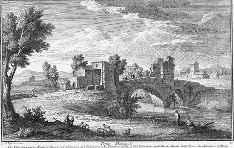
Figure 4: Ponte Mammolo, 1754, Source: romeartlover.it

Figure 5: Ponte Salaris, 1754, Source: romeartlover.it

Figure 6: Ponte di San Francesco, 1901, Source: eBay.it
Green Infrastructure consists of spatially or functionally connected areas which maintain ecological coherence as an essential condition for healthy ecosystems. Added value comes from its capacity to attract broader investments in natural capital. More direct benefits include ‘greening’ the existing infrastructure, strengthening the functionality of ecosystems for delivering goods and services, mitigating and adapting to climate change effects, as well as enhancing the quality of life in general (through e.g. health, tourism, conserving historic and cultural heritage).
Environmentally and ecologically speaking, the Aniene River represents a major challenge in the Roman area, a Metropolitan City collecting some 100 municipalities and 4 million inhabitants.
The improvement of the habitat and the quality of the river can enhance opportunities for a range of economic and social benefits, such as the promotion of advanced recreational resources, the increase in quality of life and, last but not least, the increase in land values.
3

Figure 7: The Aniene River along the “Tiburtina Valley”, Source: google earth

Figure 8: The Aniene River near the peri-urban settlement of Case Rosse, Source: google earth

Figure 9: The Aniene River between Tivoli and the settlement of Villa Adriana, Source: google earth
Aniene Flow - Section 3
UNlost territories- Aniene flow project is comprised of 15 sections. We decided to explore section three, starting from via dei Prati Fiscali passing through the train-line linking Roma Tiburtina and Nuovo Salario stations. This section has potential due to several reasons; having the bridge linking both sides of the river in the west, Museo della Zecca di Roma on the northern side of the river, and a dense urban tissue to the northeast.


Figure 10: The Aniene flow sections, Source: Google Earth
Figure 11: Aniene flow section 3, 3D view, Source: google earth


Figure 12: Aniene flow section 3, Source: google earth
Figure 13: Aniene flow section 3, year 2001, Source: google earth


Figure 14: Aniene flow section 3, year 2001, Source: google earth
Figure 15: Aniene flow section 3, year 2019, Source: google earth


Figure 16: Museo della Zecca di Roma, Source: Wikipedia
Figure 17: Via dei Prati Fiscali, Source: Google Earth
We studied different approaches relating to the rehabilitation and reuse of abandoned areas, looking at several successful examples from around the world such as the New York High Line project and Madrid’s Rio Manzanares River project. Through these case studies, we understood the influence of such projects on, people, environment and economy, in addition to the essential role of infrastructure (green infrastructure) in redirecting developments inside cities. In other words, we learnt the term Bio-information and the fundamental role of IT in taking care of cities.
"Looking at the Aniene Flow as a green infrastructure able to provide a very interesting development and economic boost, I cannot help but think about the challenges that such a project may face. What is the major challenge we are facing and how can we assure that a project of this size will be sustainable?"
Synopsis of Class 11
Aniene Flow A BioInformation Infrastructure for the Rehabilitation of UnLost Territories
Preliminary Concept - Similar Case Study
Looking at Part 3 of the Aniene Flow, we can see that it consists of various layers; the river itself, the trees, and a number of bridges. Our idea is to add a new layer in the form of an Eco-footbridge providing pedestrian paths, passing over the river. On both sides of the Eco-footbridge, there will be gathering places, like public parks, since both of the river borders are still green (fig.18). The bridge will have a curved shape, to fit well with the natural surrounding and the river that is underneath (Fig.19).

Figure 18: Pedestrian bridge with public spaces underneath

Figure 19: Curved bridge, to fit well with its natural surrounding
The bridge will be covered with a metallic grid (fig.20), on which will be planted some types of plants (fig.21), for two reasons: the first is to decrease the visual impact on such a natural area, and secondly to provide shadow during sunny days (fig.22). Not to forget that the bridge does not take a specific regular dimension, it will be changing width and also its cover's height, to highlight its integration with nature.

Figure 20: The bridge's metallic cover

Figure 21: Plants on the cover

Figure 21: Preliminary idea of the bridge
Figure 21: Preliminary idea of the bridge

Figure 22: Preliminary idea of the bridge's landing
PART ONE: 3. CITY, 3.1 Display versus Clock
Now although this situation can be consciously pursued in the teeming cities of the distant Orient, historic European cities cannot accept the annulment of time without annulling their own logic and peculiarity. The challenge obviously is to include the natural, historic time of European cities in a system with today’s simultaneity and constant “refresh rate.” This is possible if we understand that modernity means accepting crisis, changing so as not to fade away.
Question: How can we achieve and overcome this challenge? and also, how can we better promote this meaning of modernity? As in many cases projects fail because of people being afraid of change; believing that modernity contradicts with the ancient. They would rather fade away than change.
PROJECT | 04- A
"Thoughts On A Paradigm Shift The It Revolution In Architecture" by Antonino Saggio

SHoP Works, Digital constructive collaborations book displays the work and activities carried out by SHoP Architects, an architecture firm based in New York. A success story of a firm breaking traditional ways of architectural design and construction, following the concept of integrated approach and using most of the available computing tools and digital technologies for the different phases of a project. It presents a number of case studies implemented by ShoP Architects with a focus on design development and research in every project while maintaining perspective on the big picture. Starting with the small-scale project “demos” developed in early 2000, to the “Clubhouse” at JFK airport to the more sophisticated ones that have been completed more recently (Fig.1).
Design and architecture are issues of collaboration between a number of disciplines in addition to the variety of computing tools to design process and construct. SHoP Architects as an example, they are against star architects attitude and they encourage collaborations and interdisciplinary work, taking computing tools and software to a new different dimension; understanding the capabilities of each one of these tools. This is what Micheal Speaks call ‘”Design Intelligence”.
Although computing tools are mature enough and flexible allowing for the creation of constantly adjustable models, in addition to allowing design development and construction to happen in parallel sometimes, they are very crucial when it comes to the issue of management. These tools if managed properly they can bring out stunning successful projects and lead to unexpected significant results. On the other hand, they can devalue the project’s intent if misused.
SHoP gave great attention to the management issue always following their own steps. Being different with their anti-star attitude as well as having a strong connection with experimentation and listening to various opinions. They were able to prove themselves and come up with significant results. Another important characteristic to be mentioned is their continuous search with themes of variations, dynamic textures and components modified to pursue a contemporary and digital dimension.
To mention an example of their work we can look at the Houston Street Façade (Fig.2), where it is evident the different attempts and change in softwares a project can go throw. In this case, they had to change from one software to another to reach the most outstanding satisfying results, as there is always a software for each problem (fig.3).
As a conclusion, we realize that the more complicated a project or design is the more experimentation on digital techniques it needs. Requiring the need to use a combination of softwares to produce models and ease the interaction with consultants, developers and builders. Moreover, the more complex a project is the more responsibility it requires, not only on the design but also on the whole process and outcome at each level of the project.

PROJECT | 04 - B
"SHoP Works Digital Constructive Collaborations", Stefano Converso preface by Antonino Saggio
Figure 1: Nesting on the standard wood panels of the components for the Virgin Atlantic Clubhouse: the pavilion designed by SHoP for the airline inside the Terminal 4 of JFK airport in New York

